Saturday, 12 December 2015

What's cooking in Maps in GNOME 3.20

We are coming up on the 3.19.3 release this Monday and 3.19.4 will be January 14th which will also be the start of the UI freeze.

I wanted to take some time and give an update on what we have done for Maps this cycle and what we can expect in Maps 3.20.

Open with browser

We have had support to open a location with other applications for a while. New in 3.20 will be Open with browser. That will send you to the OpenStreetMap page for the location in question.


Fun with URIs

Maps in 3.20 will be able to handle the 'geo' URI scheme. That means that if you follow the link in the previous sentence and go to the wiki page and click on a geo: URI, your browser will suggest that you open the URI with Maps.

The GNOME IRC application Polari has also gotten support to linkify the geo: URI.


Geojson

I wrote about this in an earlier blog post we now have support for opening GeoJSON file, that contain simple geometric shapes and annotations. Since then contributor Alaf Azam added initial support for the Mapbox simple style specification for styling GeoJSON data. Which mean we can have stuff looking pretty like below.


Export to PNG

We added functionality to export the current view to PNG.


Editing OpenStreetMap from Maps

One thing I have wanted for a while now is happening thanks to Marcus Lundbladh we will have the possibility to do simple editing of OpenStreetMap from GNOME Maps. He has written a more in-detail blog post about it here.

Right now we have merged support to add/alter fields of information in places that already exist. And we will expand on that and maybe add functionality to add points of interest. A reason to use GNOME Maps is that we use the open data from OpenStreetMap and it feels good to offer a way to give data back.


So all of this and more, like going to your last previous location on start-up is what is happening in Maps for 3.20. And we also got two Outreachy interns for Maps for this round! I will introduce them and what they will work on in a later blog installment!

Monday, 26 October 2015

GeoJSON in Maps


For Maps 3.19.1 release we managed to land some support for showing  a GeoJSON layer. This means that you can get a GeoJSON file from somewhere then open it with Maps.

Usage

The different ways to load GeoJSON with Maps is currently...
... from the command line: gnome-maps file.geojson
... drag the file to a Maps window
... double click the file to open it with Maps


In order for double clicking the GeoJSON file to work we need to install the application/vnd.geo+json mime-type on the desktop. I have added the mime-type to the freedesktop.org component shared-mime-info. So you will need a release from that module or build it yourself from Git.

GeoJSON files can be used to create a custom layer above the map. For instance displaying political areas like counties or voting area. An example would be all the municipalities of Norway.


You can also add different places, for instance GUADEC this year will be at Karlsruhe. The bid I saw included four different options for venue. We could map this using GeoJSON (I used geojson.io) to create a layer showing the different options on the map.


Heavy lifting by Mapbox

It turns out rendering large sets of GeoJSON is non-trivial. Fortunatly it is something that Mapbox already has solved with their JavaScript library called geojson-vt. Under the heading of "Rendering big geodata on the fly with GeoJSON-VT" the article describes how the library breaks down the GeoJSON set into vector tiles by filtering out features, optimizing detail and clipping.

We lift the code into Maps, we have to change the way the geojson-vt modules include each other in order to fit into the gjs way of doing things, but other than that, the code is unchanged. The code is then used to construct a libchamplain tile source and is then added as an overlay source to the map view.

Limitations

Right now the code will only handle GeoJSON files that do not change the Coordinate Reference System (crs) to something other than the one we are used to (latitude and longitude ranging from -180/-90 to 180/80).

No styling information is taken into account (except the name property for Points). There is no standard GeoJSON styling style. But we could for instance support the one from Mapbox.

Future

Styling and UX for this feature may change before we end up in 3.20. Please try it out and comment and file bugs. It will help us!

If you want to help out now there are some tasks to look at:
Thanks!

Wednesday, 30 September 2015

Do you want to contribute to Maps?

Right now we have quite a number of tasks in our Bugzilla that are suitable for someone that want to get started developing for Maps or GNOME in general.

I am going to list some of them here and maybe it will pique someones interest. However finding a first task to work on is not all that one need to do in order to start developing for GNOME. You also need to be able to build and run the latest developer version of the GNOME module you want to develop for. In order to get there I will defer to the excellent Newcomers guide.

On to the Maps entry tasks!


Remember last location and use it at start up

This task is about saving the latitude and longitude of the view you are currently viewing so that Maps can go there on start-up. Instead of starting with a view of the world every time.

So in order to solve this you will interact a bit with the GSettings framework and a bit with the ChamplainView that contains our map.


Use stars instead of hearts for favorite places


We currently use hearts for favorite places on our Map bubbles. The rest of GNOME use stars. We should use stars as well. So here you will interact a bit with CSS and with UI files.


Implement new mockups for map Bubbles


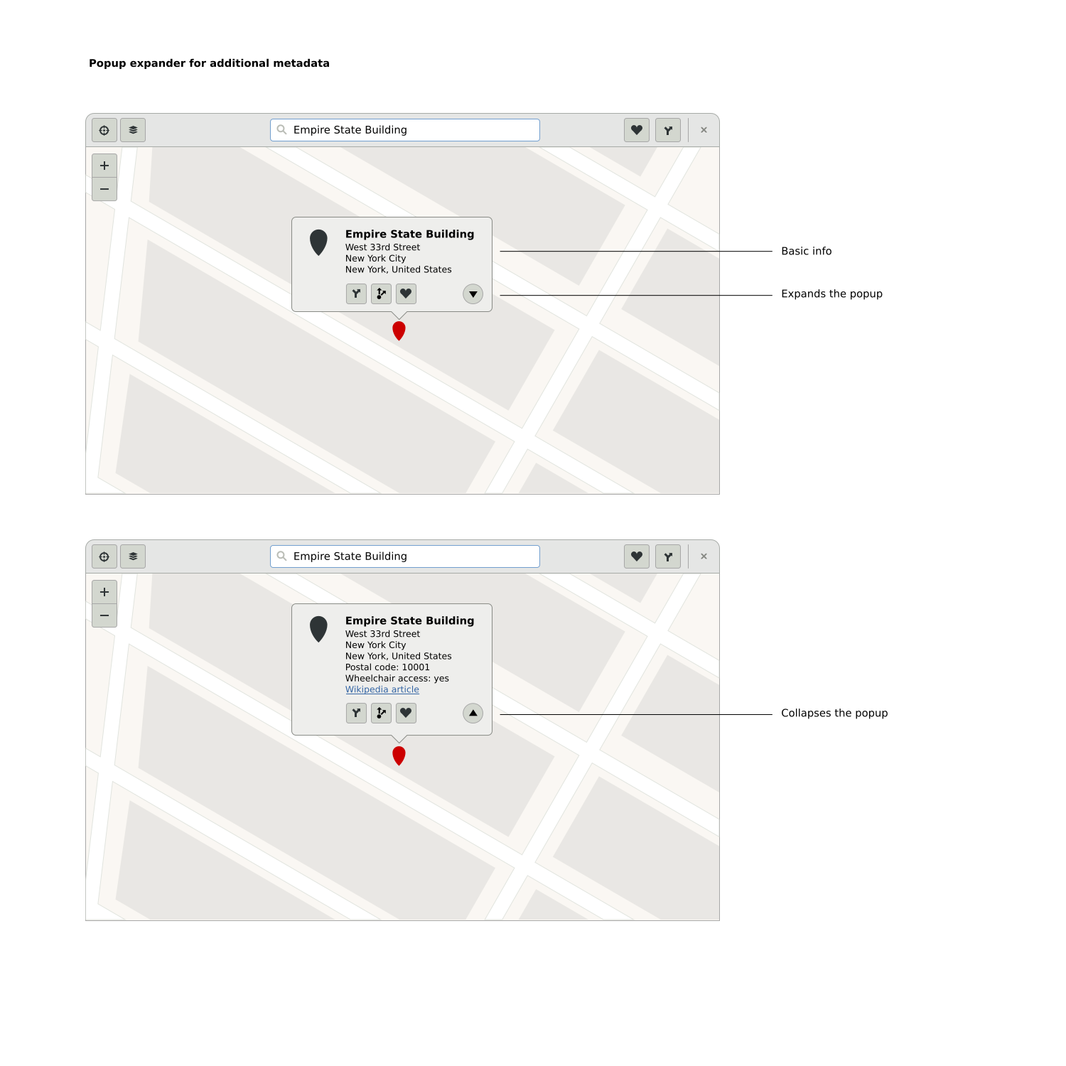
We want to fit more information in our map bubbles. New mockups have been provided in the bugzilla for this task. To solve this you need to, among other things, interact a bit with GtkBuilder ui-files.


Support roundabouts in GraphHopper route results

GraphHopper now supports roundbouts. But we do not show that in our route planner UI. For this task we need to use the information from GraphHopper in the Maps ui.


These were a few of our tasks, there are More! We want your help and need it to make Maps 3.20 the best release yet!

Thanks!

Saturday, 12 September 2015

Using offline (local) tiles with GNOME Maps

I managed to get a freeze exception to include a new feature in Maps for 3.18. It is now possible to use local, offline, tiles by using the --local command line option.
What you need are image map tiles, organized in a standard way in a directory. Then you can point Maps towards that directory and have local tiles usable offline.

For instance, I downloaded a bounding box of London. In the zoom-levels of 11, 12, 13, 14 and 15. The tiles are organized as Z/X/Y.png. Where Z is zoom-level, X and Y are the tile numbers. London at those zoom-levels will be 2750 tiles and about 60M.

I used a perl script found while googling. Please be advised to follow the tile servers usage policy before attempting bulk downloading of tiles.

$ tree london/
london/
├── 11
│   ├── 1022
│   │   ├── 679.png
│   │   ├── 680.png
│   │   ├── 681.png
│   │   └── 682.png
│   ├── 1023
│   │   ├── 679.png
│   │   ├── 680.png
│   │   ├── 681.png
│   │   └── 682.png
│   └── 1024
│       ├── 679.png
│       ├── 680.png
│       ├── 681.png
│       └── 682.png
├── 12
│   ├── 2044
│   │   ├── 1359.png
│   │   ├── 1360.png


Using this I can do:
$ jhbuild run gnome-maps --local ~/london


So this is kind of an hidden feature. So that we can test using offline tiles before we find a way of getting downloading into Maps. One kind of major issue right now is where do we get the tiles? Bulk downloading tiles from OpenStreetMaps is not very nice. OSM is a non-profit org. run by volunteers on donations. We do not want to leach on bandwidth. So we need a way around this. Maybe host our own?

Please also consider that when and if you want to download tiles to try this Maps feature. See the tile usage policy about bulk downloading. And try to follow it!

Please enjoy!

Monday, 10 August 2015

GNOME Maps presence at GUADEC 2015

GUADEC is the GNOME Users And Developers European Conference. This year it was held in Gothenburg.

I presented a talk about Client side rendering of maps using MapCSS.
I will embed the slide for that talk to this post. There will also be videos later on, as all talks were recorded.

After the core days we had an opportunity to gather an informal Maps BoF 
were interested gathered to talk about our roadmap. We also managed to jot down some ideas for future GSoC / Outreacy proposals.

You can find the updated roadmap here.

We are late in the 3.18 cycle and we have not had the amount of developer bandwidth we would have liked. But I still want to get in some stuff before the freezes. I would love some help from you!

For  3.20 we are more ambitious. And we want to land some features.
Right now the plan is to go for:
  • Basic editing of OpenStreetMap data from Maps (bug)
  • Printing of routes (bug)
  • Opening and displaying geographic annotation and visualization, possibly through KML files
  • Integration with OwnCloud (bug)
  • Some sort of support for client side rendering
  • Further support for offline tiles
  • Someway to download tile
There are some nice projects and bugs to work on in Maps. If you want to get involved please check out our gnome-love bugs. And come visit us at #gnome-maps on irc.gnome.org.


Wednesday, 22 July 2015

GUADEC at Folkets Hus Gothenburg


GUADEC is the GNOME Users And Developers European Conference. It is an annual conference taking place in Europe, whose prime topic is the development of the GNOME desktop environment.

This year GUADEC will take place at Gothenburg, Sweden on August 7 – 9 the core days at Folkets Hus. I am not sure that people are aware of what a Folkets Hus is, so I thought I'd take a moment to write something about them and their history.


At the end of the 19th century, the trade unions and the labour movement began to organise themselves in earnest. This meant they needed places to get together, to hold meetings and for education. This might seem innocent enough, but the opposition was great. Workers were not welcome to use existing premises. Landowners forbade open-air meetings, as fear for revolutionary ideas was great.


So the labour movement in southern Sweden decided to buy land, build houses and use them for their organisational needs without interference. The idea spread and all over the country Folkets Hus was constructed. And not only houses: Amusement Parks, Zoos, Open Air theaters, Cinemas and much more. The Folkets Hus movement was important for making the labour movement a part of peoples lives. Today the People's park and communiy centre movement is made up of about 600 meeting places in Sweden.

The People's park are a natural part of many cities and their connection to the early days of the labour movement are beginning to fade away in common memory.

People's park in Malmö

The Folkets Hus in Gothenburg, where GUADEC will be held, was constructed between 1948 and 1951. In 1956 a cinema and restaurant/dance hall was added.


Since then people have gathered there for dance, movies, study circles and for meetings and social events. Today Folkets Hus in Gothenburg acts as a venue for conferences  a part of Göteborg Film Festival a workplace for hundreds of people and a home to a large art collection.

I hope you will enjoy it here!

Tuesday, 5 May 2015

Client side rendering of our map using MapCSS!

We want to support an offline mode in GNOME Maps. A mode where you could download an area and have the map data available even if you do not have an Internet connection. The problem is that we are currently using pre-rendered bitmaps. We download them and we show them. This makes supporting an offline mode a bit tough since the amount of data we would have to save would be large.

We have talked off and on about how neat it would be if we could download some kind of vector data and render the map ourselves. But never really made any progress. Until now, kind of.

I have been working on a library that I call Vector-tile-glib. This library will parse and render the Mapbox Vector tile format, and style it using MapCSS. I have hacked a bit on evenings and other spare times when my son has been asleep. It has been fun. It is not done, nor stable. But it has reached a point where I want to tell more people about it and maybe even get some help. There is much left to do, and many many rough edges.

So what I have now is pretty much something that parses the vector tile and can output something to a Cairo context using MapCSS. Or in pictures:


+


=


In order to try it out I have also written a subclass of a Champlain renderer in Maps so we can try this library out in real time. The work is on a branch on the GNOME Maps git repository  called wip/jonasdn/vector-tiles, try it out!
Andreas Nilsson and Marcus Lundblad have been helping me out with an initial style. Join them!

For you to try this, build Maps from the wip branch, then choose the aerial view to get the client side rendered map. Like in the video below:


You can also try out live editing the MapCSS, like in this video:


There are also tools to use in the vector-tile-glib repo, for rendering to PNG, dumping tags from a vector tile and downloading tiles from Mapzen tile service. See the Github README.md for more details on them.

I think this could be something cool to have. Partly for providing a path towards offline Maps and partly to have a map style of our GNOME. Help is appreciated! I am not a parser person or a render person, so I am sure I have made a bunch of really silly mistakes. Pointing them out would be helpful!